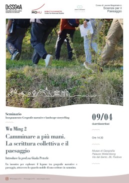
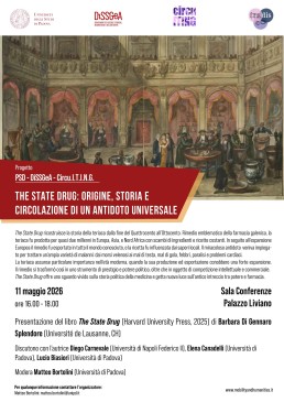
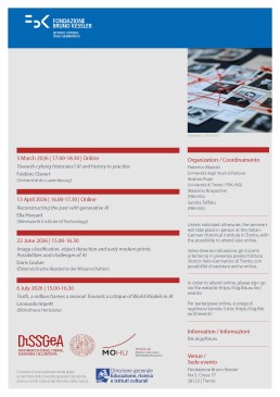
Alter–Atlas of Borders Exhibition launch | 20 March 2026
Alter–Atlas of Borders Exhibition launch | 20 March 2026
Exhibition launch | 20 March 2026
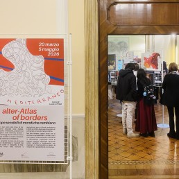
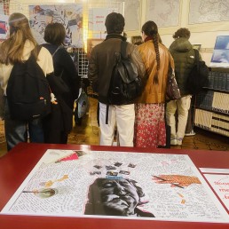
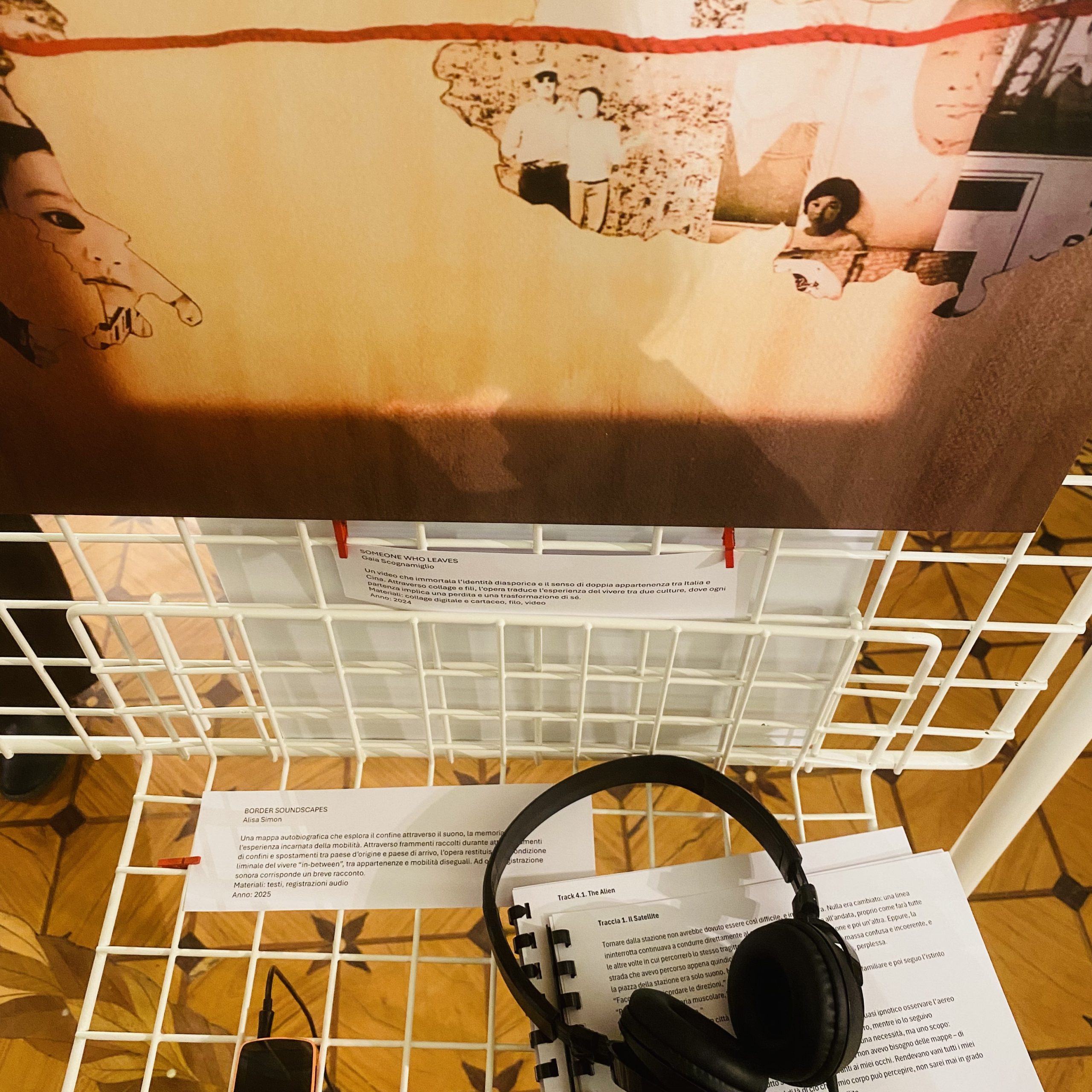
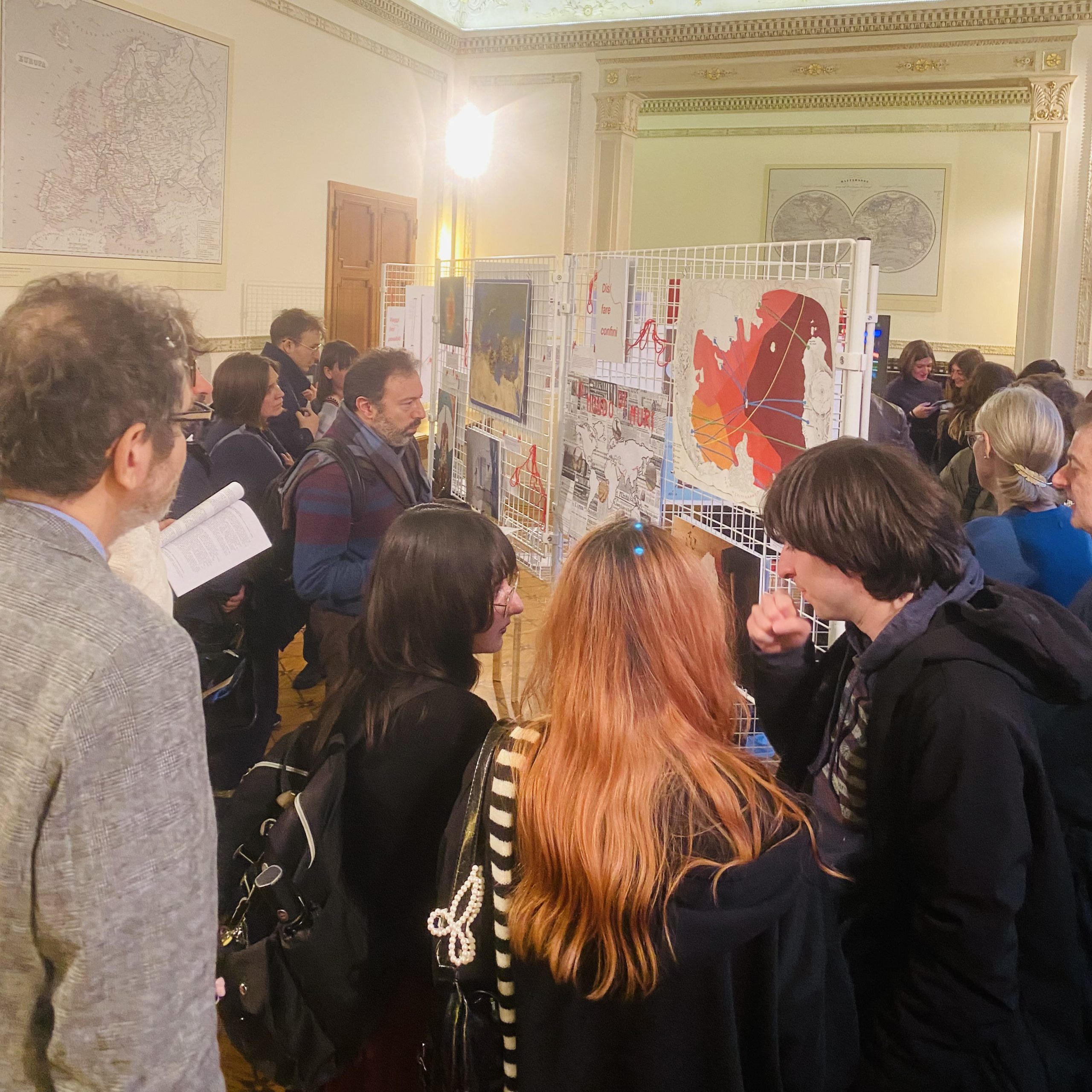
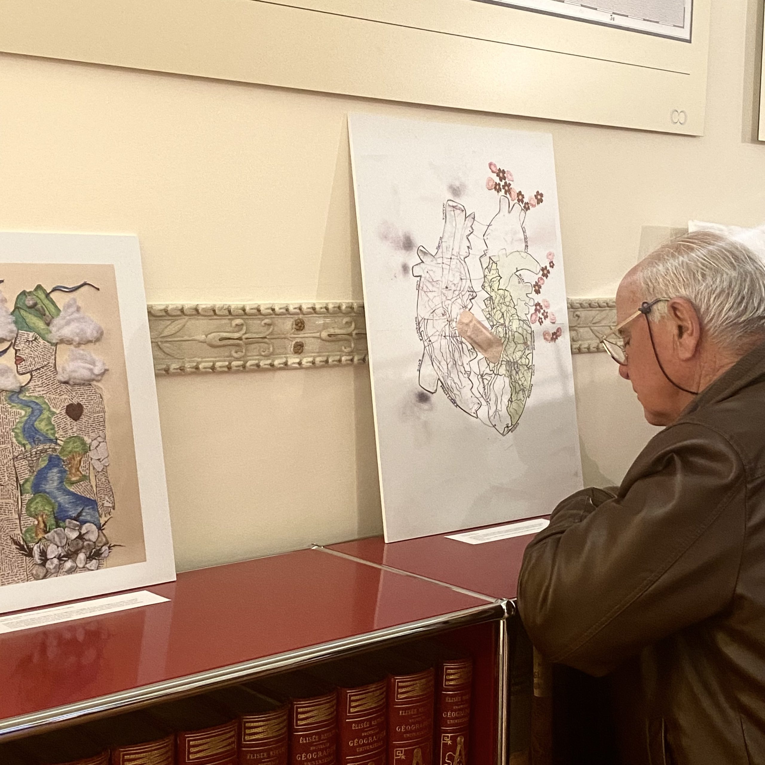
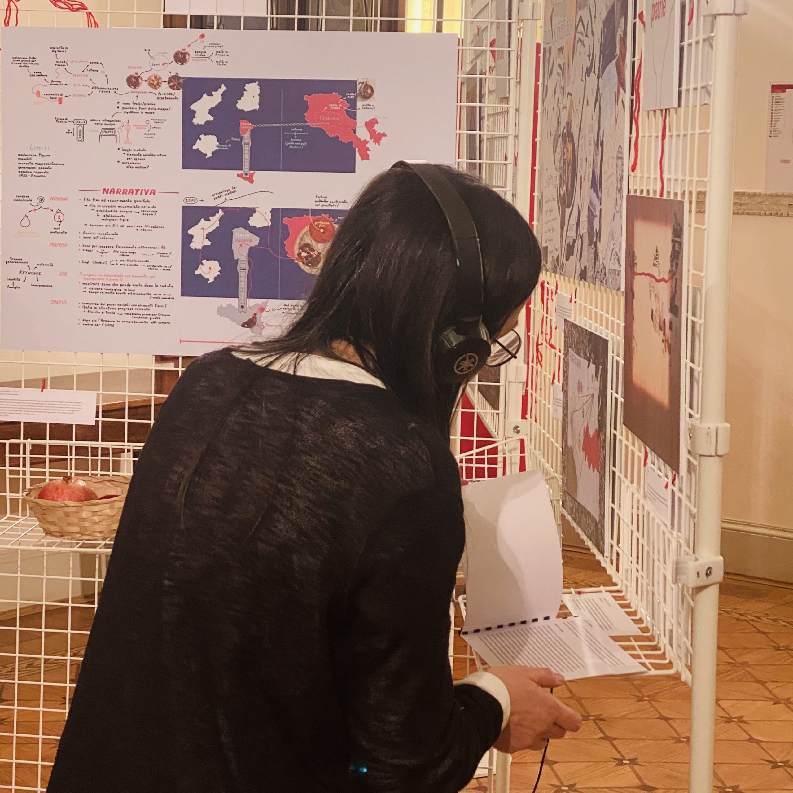
Alter–Atlas of Borders. Sensitive Maps of Changing Worlds is an exhibition curated by Laura Lo Presti, bringing together a selection of works created by students from the Mobility Studies and Geography courses at the University of Padua. The exhibition explores borders not only as geopolitical lines, but as embodied thresholds. Through the lens of critical and humanistic cartographies, the exhibited works engage with themes of mobility, estrangement, and the shifting conditions of belonging. Borders emerge here as affective, relational, and more-than-representational formations, shaped by bodies, memories, and everyday practices.
The exhibition unfolds through a series of small installations, video-performances, and printed maps, each accompanied by short explanatory texts in Italian and English. Together, these works propose alternative ways of seeing and inhabiting borders, inviting visitors to reflect on the political and experiential dimensions of mapping in a world in constant transformation.
Alter–Atlas of Borders is an invitation to rethink maps as living, situated practices, capable not only of representing the world, but of questioning, transforming, and reimagining it.
The exhibition opens on Friday 20 March at 17:00 and will be on view until 5 May 2026 at the Museum of Geography, University of Padua.
Opening hours:
Tuesdays, 15:00–18:00
Sundays, 14:30–18:30
Events
28–29 March, various times
Let’s Play with the World’s Languages
Family event with children
An unmissable opportunity to explore the role of borders and mapping within the global linguistic framework. The event will feature four activities inside the spaces of the Museum of Geography. The exhibition Alter-Atlas of Borders will host the first stop of this engaging and educational journey aimed at children and young people up to 15 years old. More details and tickets will be made available on this page soon.
Click here for more information and to take part in the event!
2 April, 6:45 PM
altars.csv – Musical Performance on Cartography and Movement
by Mattia Benedetti: live electronics and Greta Romani: clarinet / percussion
Audio / Video / Text: the live performance uses these three elements as the basis of an algorithmic exploration. It starts from map fragments (as a deconstructed, lo-fi visual element), textual debris (verb extractions from 19th-century novels, maintenance condition annotations, piles of incomprehensible characters) and scattered data (location identification codes, Excel spreadsheets, latitude and longitude) to arrive at a rarefied and suspended expressiveness.
Click here to register for free and take part in the event!
10 April, 5:30 PM
Art, Cartography and the Geopolitics of Care?
A talk with Laura Canali
A public talk with artist and cartographer Laura Canali, author of the maps for Limes, dedicated to the relationships between art, cartography and geopolitics. The conversation will reflect on how artistic cartography can challenge dominant geopolitical representations and open up different ways of imagining borders: not just lines of control and separation, but also spaces of relationship, vulnerability and care. To follow, a guided tour of the exhibition Alter–Atlas of Borders: Sensitive Maps of Changing Worlds.
Click here to register for free and take part in the event!
21 April, 4:30 PM
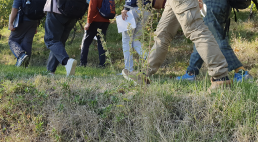
Tied Routes: A Gaming Experience on Migration Routes
With Daniel Zilio, Isabel Rasmussen
An open public gaming session dedicated to Tied Routes, a hybrid (physical-digital) serious game that invites participants to take on the role of a migrant on a journey. Through choices, obstacles and unexpected events, the game allows players to immersively explore the complexity, uncertainty and constraints that characterise contemporary migration routes.
Click here to register for free and take part in the event!

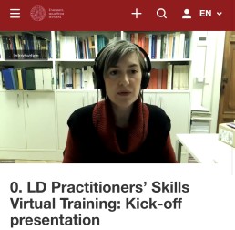
Local Development Practitioners’ Skills Virtual Training: Kick-off presentation
LD Practitioners’ Skills Virtual Training | 27 March – 26 May 2026
Online
from 27.03.2026 to 26.05.2026
Local Development Practitioners’ Skills Virtual Training
- What: This virtual training provides an innovative pathway to test and develop practical tools for the Local Development job market. Sessions are delivered by experienced professionals currently active in the field.
- When: The training programme consists of three online interactive sessions, each lasting 90 to 120 minutes, one per month from March to May 2026.
- Target audience: Second-year Local Development students and alumni
- With: Prof. Chiara Rabbiosi, Vincenzo Pono (tutor), and representatives from stakeholders including 21Solutions, Angoli di Mondo, and ADSB Consulting.
Participation is free, but each workshop is limited to 30 participants. Preparation will be required from both hosts and attendees.
Each workshop requires registration through a Zoom link that will be provided on this page.
Workshop 1: 27/03/2026, 3:30 PM
Collaboration in Decision-Making: Let’s Search Together
Host: 21Solutions
Register by 13/03/2026 at: https://unipd.link/collaboration
Workshop 2: 29/04/2026 3.30 pm
Social Reporting: From Obligation to Strategic Opportunity for Storytelling and Engagement
Host: Angoli di Mondo social cooperative
Workshop 3: 26/05/2026, 3:30 PM
Financial Project Reporting: Pretend to be a Financial Manager
Host: ADSB Consulting
Participants who attend all three workshops in the series will receive a certificate of attendance.
Watch the recording of the Virtual Training kick-off:
The Local Development Practitioners’ Skills Virtual Training is a social engagement initiative involving stakeholders supported by funds from Shaping a World Class University 2025 within the PSD project activities with DiSSGGeA stakeholders.
More info at: master.localdevelopment@unipd.it
Scientific coordinator: Prof. Chiara Rabbiosi


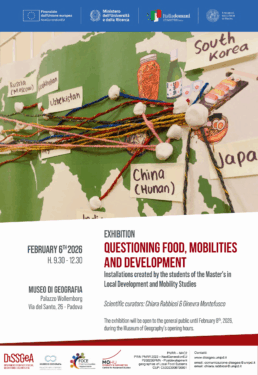
Questioning Food, Mobilities & Development | 6 Feb 2026
Questioning Food, Mobilities & Development | 6 Feb 2026
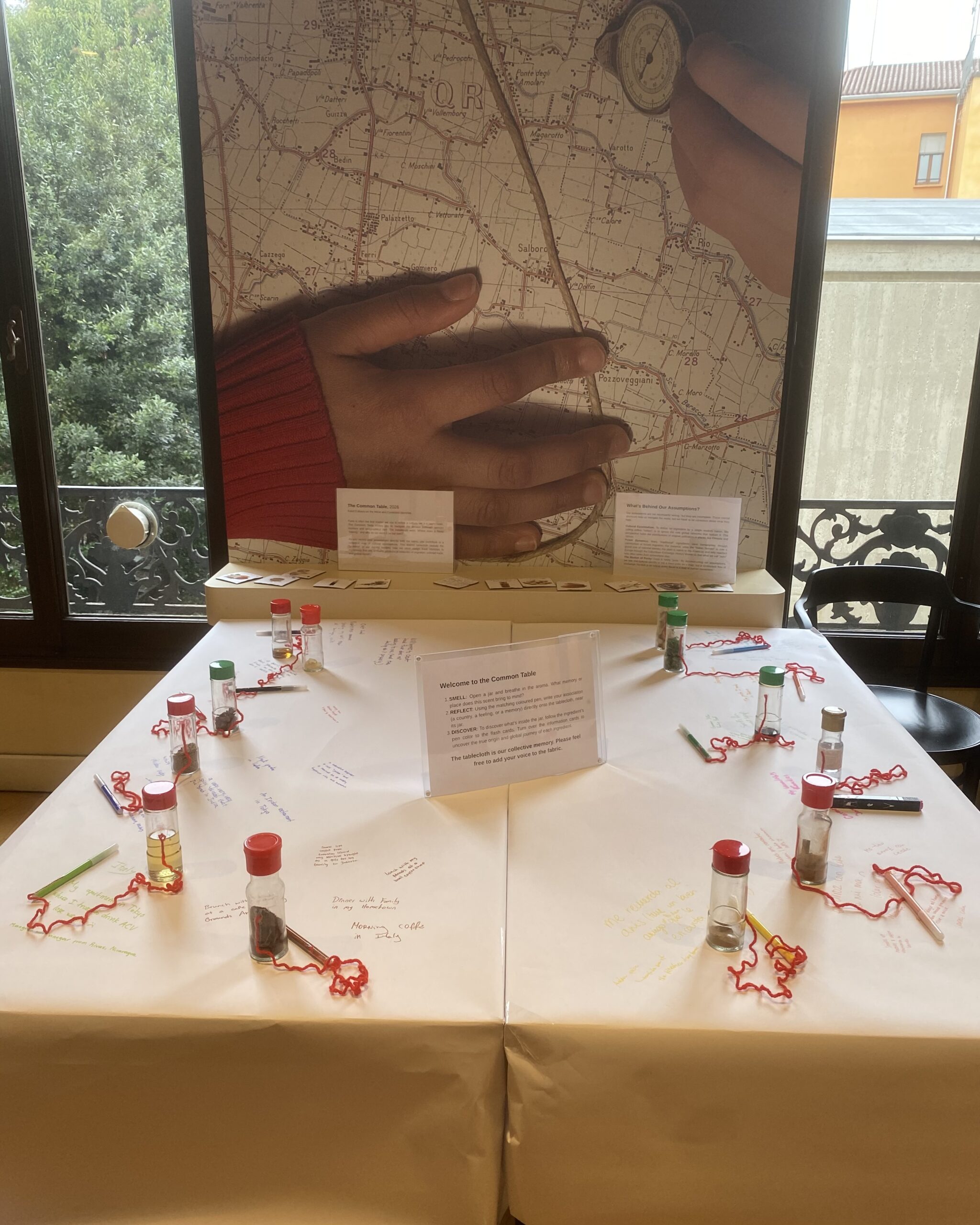
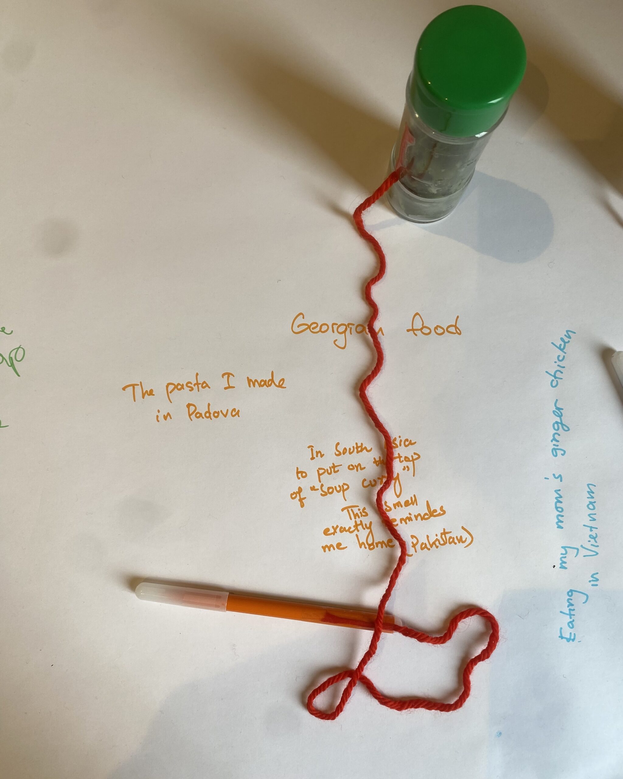
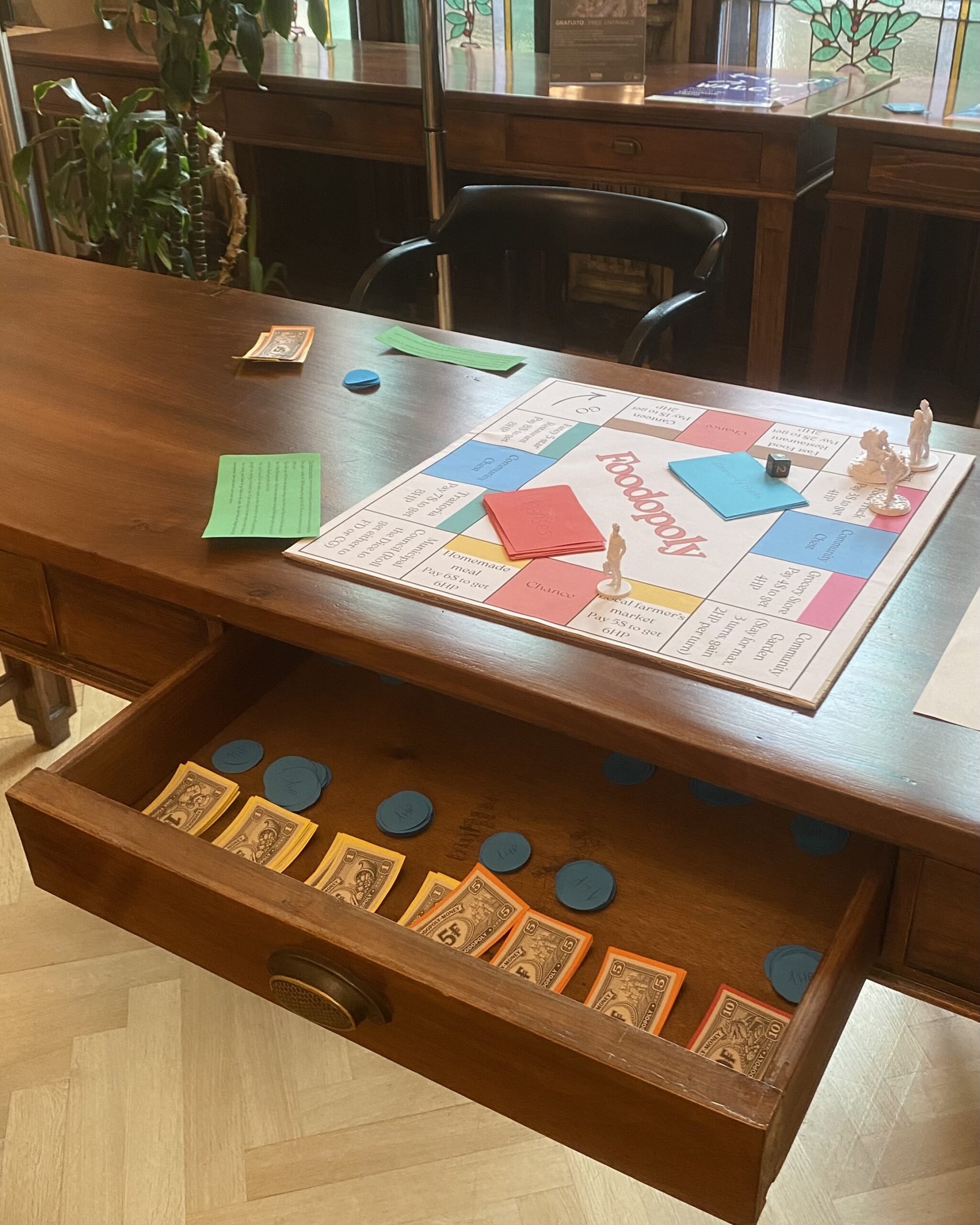
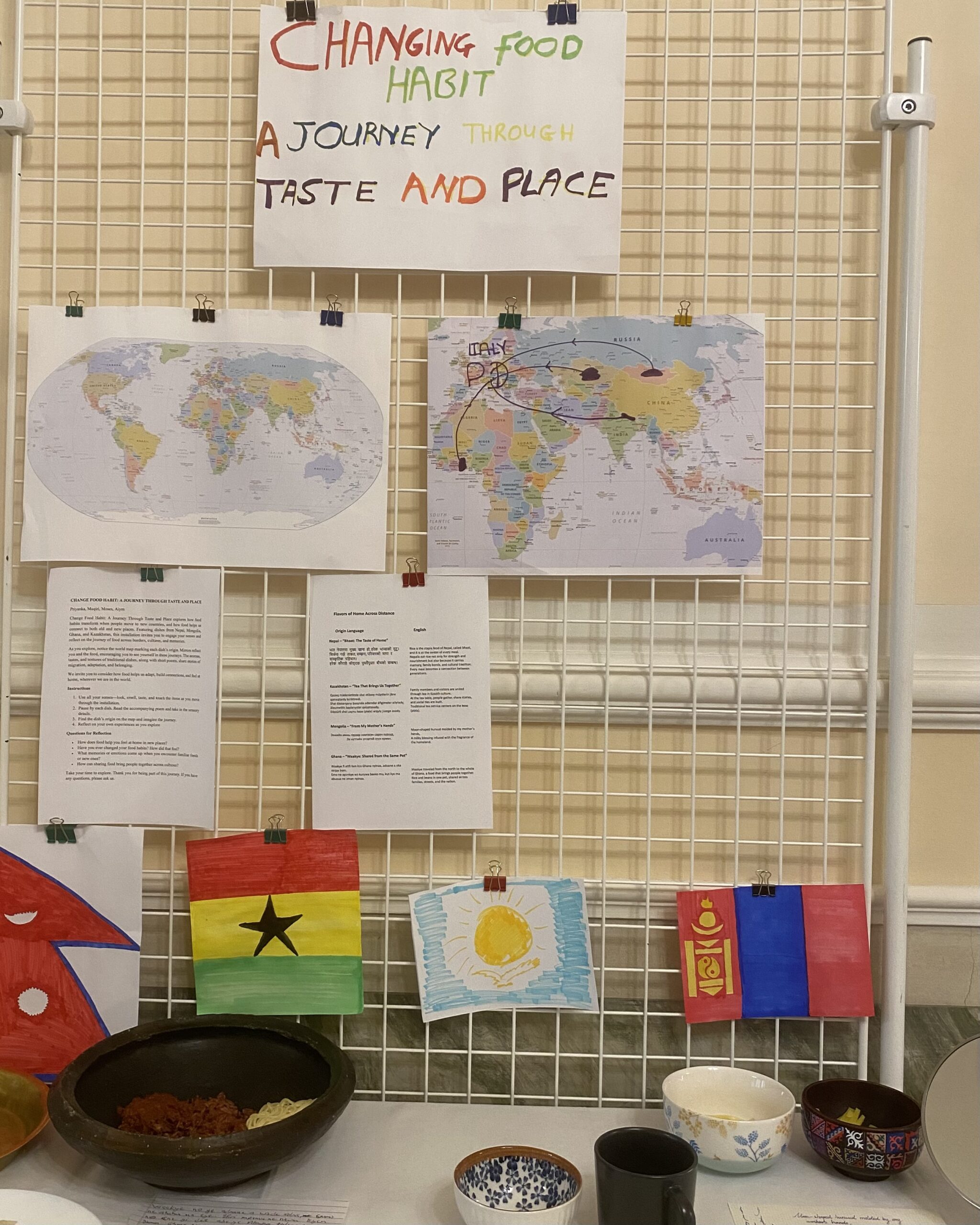
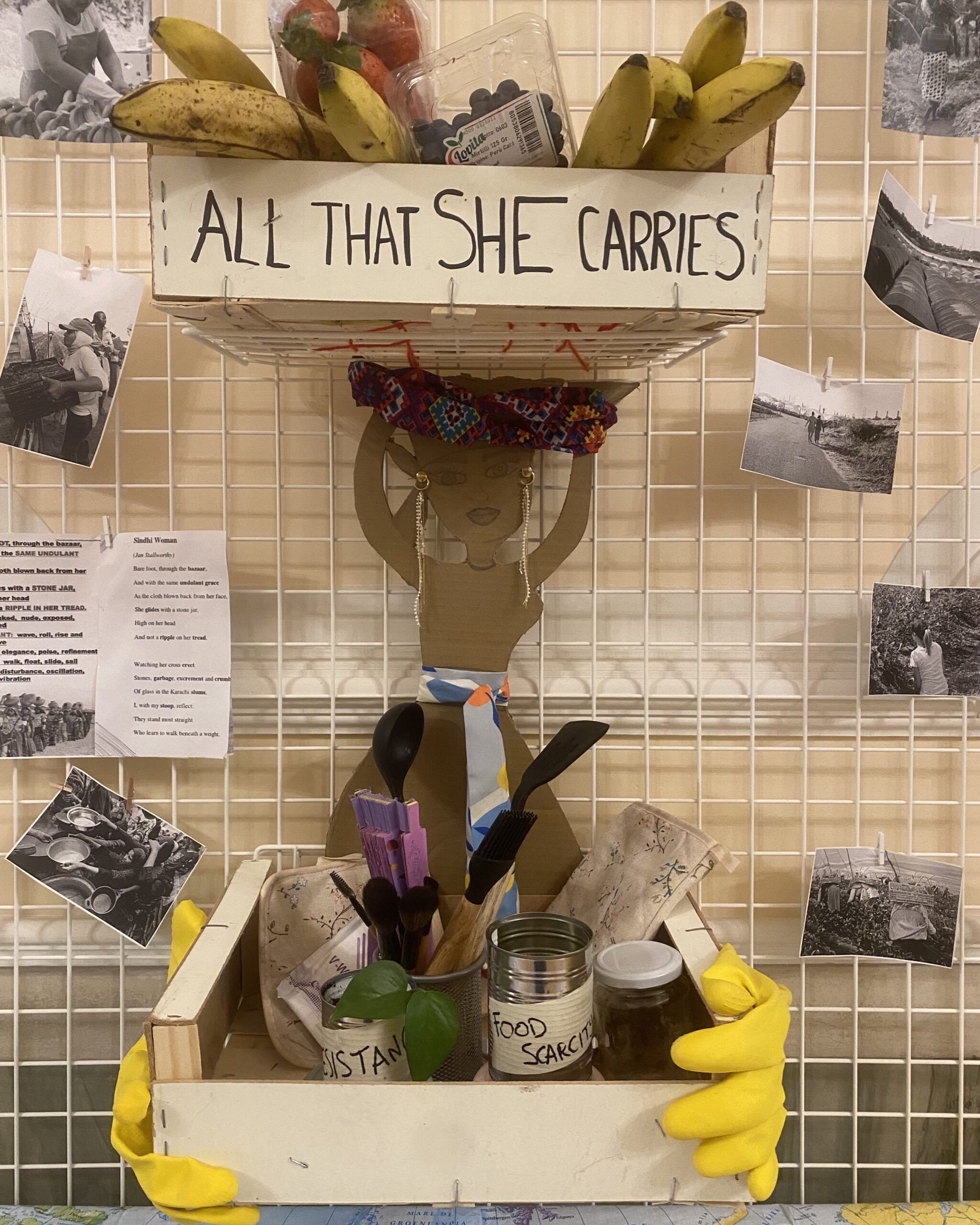
Curated by Chiara Rabbiosi and Ginevra Montefusco, the Questioning Food, Mobilities, and Development exhibition will open on February 6 at 09.30 am and will be open to the public until February 8, 2026 at the Museum of Geography, Palazzo Wollemborg, Via del Santo 26, Padova.
Representing the culmination of the Space, Place, and Mobility course unit, this exhibition showcases a rich and creative learning journey developed in collaboration with students from the Local Development and Mobility Studies Master’s programmes. It is also connected to the activities of the Food Communities Empowerment research group and forms part of the activities conducted within the Post-development Geographies of Local Food Systems: Community-Based Networks Addressing Food Insecurity PRIN 2022 PNRR project, which is funded by the European Union – NextGenerationEU.
Starting from the core geographical concepts of space, place and scale, the exhibition progressively explores the multiple meanings of food ‘on the move’, including the material, symbolic, political and relational aspects. Designed as a pedagogical experiment, the exhibition is a result of an educational training integrating theoretical frameworks, empirical case studies, and creative experimentation.
The exhibition format translates this research and teaching endeavour into an open, participatory experience, demonstrating how creative methodologies can foster learning by doing while engaging wider audiences beyond the classroom and boosting the university’s societal impact.